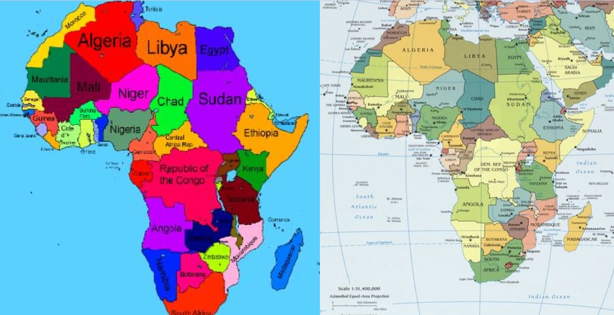
Ethiopia apologizes over African map-mistake of incorporating Somalia into its territory

- Country:
- Ethiopia
Ethiopia’s foreign ministry has apologized after uploading a map on its website that incorporated neighbouring Somalia within its borders.
Apart from incorporating Somalia within Ethiopia’s borders, the map also showed that the Republic of Congo and the Democratic Republic of Congo had become one country and it did not show South Sudan, which split from Sudan in 2011.
There has been no official comment from the Somali government. Former Foreign Minister Yusuf Garaad welcomed the removal of the map but queried how and why it was drawn in the first place.
"We sincerely regret any confusion and misunderstanding this incident might have caused," the statement said. The map caused a stir on social media with some suggesting the faux pas was an indication of Ethiopia’s plan to annex Somalia.
On the other hand, the map on Ethiopia’s foreign ministry also portrayed Somaliland, which is a self-declared state and not internationally recognized, but only internationally considered to be an autonomous region of Somalia.
Ethiopia and Somalia had a bad history with two wars being fought in the 1960s and 1970s and a civil war happening three years after a peace accord was signed in 1988. Relations between the two countries improved since Ethiopia's Prime Minister Abiy Ahmed came to power last year as he has sought to defuse tensions in the region, BBC noted.
While some Somalis say it’s a wider plan by Ethiopia to annex their country, others hit back with their own version of a map of Africa, incorporating Ethiopia into Somalia.
Somali Democratic Republic This is The accuracy Map of Our country Somalia.#Great_Somalia #Somaliwayn pic.twitter.com/M9HSYOjAgn
— Hareed abass Nour (@hareed_Abass) May 26, 2019
Also Read: World Bank-funded Kilinto Industrial Park in Ethiopia lures global pharmaceutical firms


