Revolutionizing Agriculture: A New Era of Precision Mapping in Asia and the Pacific
The Asian Development Bank's report "Plotting from Above: Enhancing Agricultural Mapping in Asia and the Pacific" explores the transformative impact of geospatial technologies on agricultural statistics. It highlights case studies from the Cook Islands, Armenia, and Lao PDR, emphasizing the benefits and challenges of using GPS and satellite imagery for land measurement. The report advocates for integrating these technologies into agricultural surveys to improve data accuracy and resource management.
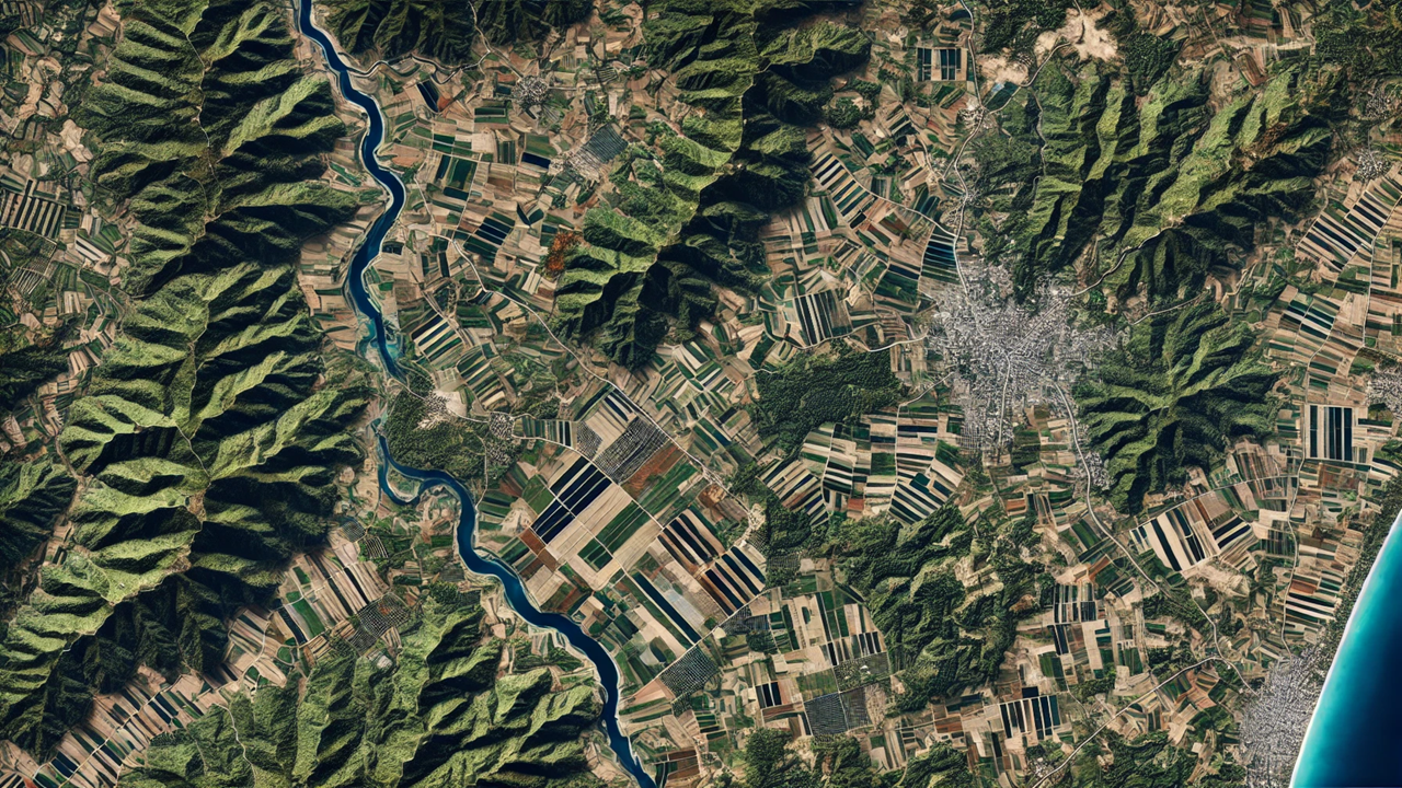
In a groundbreaking report titled "Plotting from Above: Enhancing Agricultural Mapping in Asia and the Pacific," the Asian Development Bank (ADB) explores the transformative impact of geospatial technologies on agricultural statistics. Authored by Anthony Burgard, Anna Christine Durante, Pamela Lapitan, Mahinthan Joseph Mariasingham, Arturo Y. Pacificador Jr., and Mashal Riaz, and published in June 2024, the report details how innovations like GPS, satellite imagery, and unmanned aerial vehicles (UAVs) are revolutionizing the field.
Historically, agricultural statistics have relied on traditional methods that often involved farmers’ subjective recall of land areas, a practice fraught with inaccuracies. However, the advent of affordable geospatial technologies has ushered in a new era of precision and efficiency. These technologies, once prohibitively expensive, are now more accessible thanks to initiatives by organizations like the European Space Agency (ESA) and NASA, which have made high-resolution satellite imagery freely available as a global public good.
Case Studies Highlighting Innovation
The ADB's report delves into several case studies across the Asia-Pacific region, showcasing the practical applications and benefits of these technologies.
Cook Islands: High-Resolution Insights
In the Cook Islands, the 2022 Post Enumeration Survey (PES) utilized high-resolution satellite imagery to map and classify land as agricultural or non-agricultural. This innovative approach revealed significant discrepancies between farmer-reported land areas and those measured using GPS technology. The findings suggest that traditional methods tend to underreport agricultural land, pointing to a substantial increase in land use over the past decade. This growth aligns with the broader expansion of the agriculture sector in the region.
Armenia: Challenges and Accuracy
A pilot study in Armenia's Berdik village highlighted the challenges of using digital mapping techniques. Despite having a detailed land cadastre system, discrepancies were noted between farmer-reported and GPS-measured areas. These differences were attributed to outdated records and the reorganization of land plots by farmers over time. The study emphasized the need for up-to-date and detailed base maps to ensure accurate digitization and measurement.
Lao PDR: Navigating Complex Terrain
In Lao PDR, the study tested various GPS measurement methods in Pak Pok village. It found significant underestimation in farmer-reported areas compared to GPS measurements. The challenges faced included handling large satellite images and navigating the complex terrain. The study underlined the necessity for standardized equipment and thorough pre-survey planning to overcome these obstacles and ensure accurate data collection.
Policy Implications and Recommendations
The ADB report stresses the critical importance of integrating objective measurement practices into agricultural surveys to enhance data accuracy. It recommends building geospatial capacity within national statistics offices and agricultural ministries, providing adequate training for field staff, and managing logistical challenges effectively. Standardizing these practices can significantly improve resource allocation, agricultural planning, and food security strategies across the region.
By leveraging geospatial technologies, policymakers can gain a more precise understanding of agricultural productivity, enabling them to make informed decisions that enhance food security and resource management. The report also highlights the potential environmental benefits, such as better planning for land use and mitigating the impact of agriculture on natural forests and biodiversity.
Vision for the Future
"Plotting from Above" illustrates the vast potential of geospatial technologies in transforming agricultural statistics. By addressing the biases inherent in traditional methods and embracing advanced mapping techniques, the report provides valuable insights for policymakers and statisticians. These innovations pave the way for more accurate, efficient, and sustainable agricultural data collection and management, ensuring that the Asia-Pacific region can meet its agricultural and food security challenges in the coming years.
- FIRST PUBLISHED IN:
- Devdiscourse


