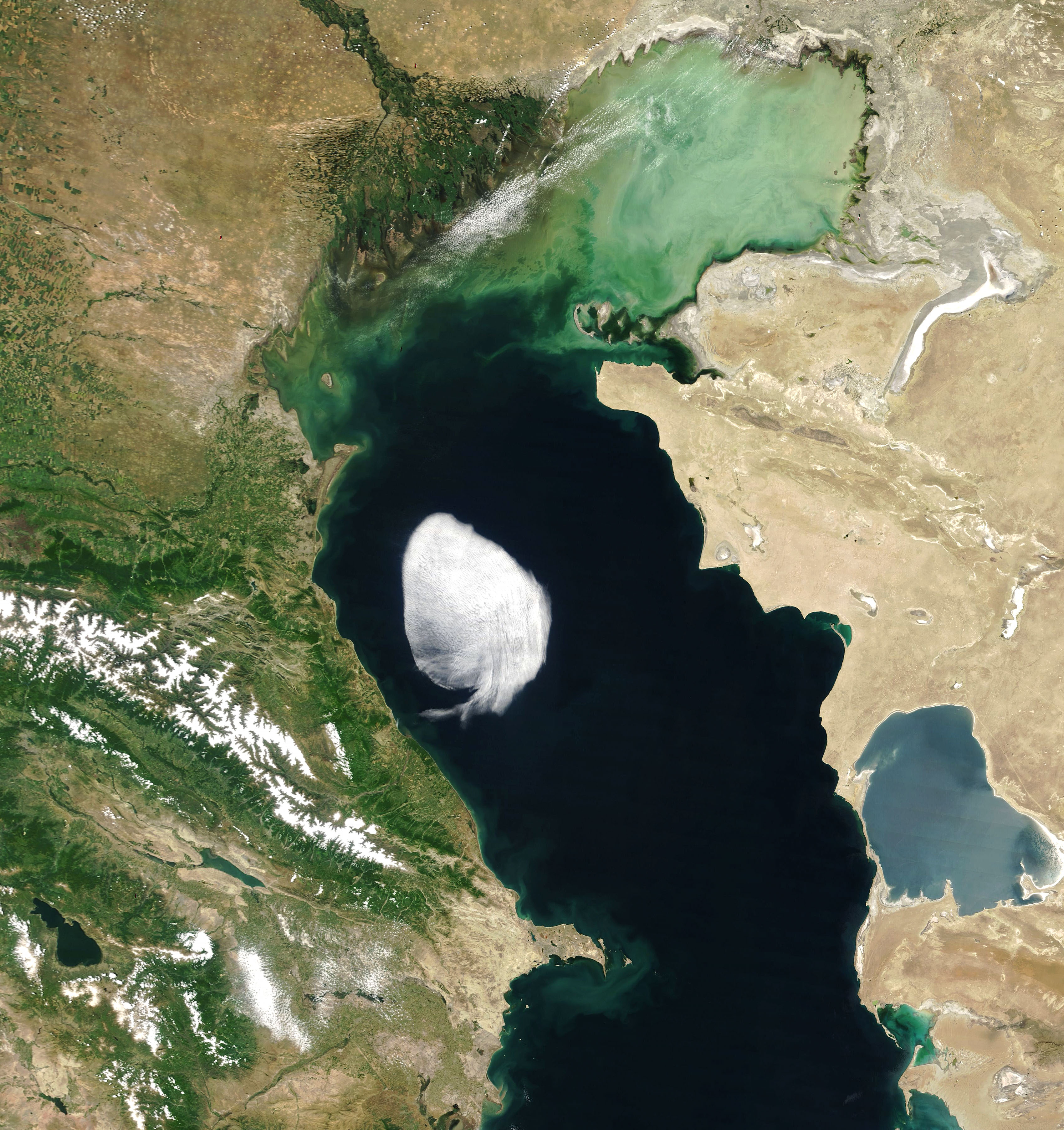
NASA satellite sees strange cloud drifting over Caspian: What makes it look more peculiar than most?

NASA's Terra satellite recently captured a lone cloud drifting over the Caspian Sea, the planet's largest inland body of water, that stands out from other clouds hovering over the sea. The NASA Earth Observatory team describes this cloud as 'more peculiar than most'.
Captured by the Moderate Resolution Imaging Spectroradiometer (MODIS) on NASA's Terra satellite on May 28, the cloud had well-defined edges resembling something from a cartoon.
This peculiar cloud drifting over the Caspian Sea has a simple meteorological explanation. https://t.co/1br2Vyorlb pic.twitter.com/Sm8uK4pYS4
— NASA Earth (@NASAEarth) June 16, 2022
The cloud is a small stratocumulus, said Bastiaan van Diedenhoven, an atmospheric scientist at SRON Netherlands Institute for Space Research. The cloud type is puffy like a cumulus (heap/pile) cloud, but the "heaps" in a stratocumulus cloud are clumped together, forming a widespread horizontal cloud layer. The stratocumulus captured by the NASA satellite formed a layer spanning about 100 kilometers (60 miles) and the cloud was probably hovering at an altitude of about 1,500 meters (5,000 feet).
The image was pictured in the late morning when the cloud was poised over the central Caspian. By the afternoon it had drifted toward the northwest and hugged the coast of Makhachkala in Russia, along a low-lying plain near the foothills of the Caucasus Mountains.
"The cloud could have formed when warm, dry air - possibly from the Balkans - encountered colder, moist air over the Caspian sea. It then drifted across the sea and dissipated when it reached land," according to van Diedenhoven.
Terra is NASA's flagship Earth-observing satellite and its mission is to understand how Earth is changing and to identify the consequences for life on Earth. The five sensors onboard the satellite make simultaneous observations, with MODIS tracking a wider array of the earth's vital signs than any other Terra sensor.


